Content
The best events feel effortless. A concert stage rises at the perfect moment, an opening ceremony moves in sync, a brand launch transforms an empty hall into something unforgettable. But behind every seamless experience is precise spatial planning.
Before guests arrive, teams need to understand the venue clearly. Ceiling height, access routes, rigging zones, crowd flow, stage footprints, and technical constraints all determine what can be built. When those details rely on guesswork or outdated drawings, delays and redesigns often appear during installation—when time is shortest and pressure is highest.
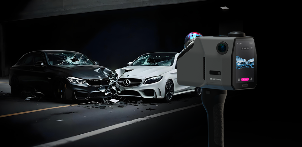
That is why portable LiDAR scanners are becoming an essential part of modern event production. They allow planners to capture real spaces quickly, turn them into accurate digital twins, and coordinate creative ideas with real-world dimensions. For large-scale events, the right scanner often saves more than time—it protects the entire workflow.
Among portable solutions, Eagle and Raven each bring different strengths. Both work with Ray Studio, enabling users to generate point clouds, colorized scans, and Gaussian splatting outputs for visualization, planning, and presentation. The difference is not which one is better—it is which one fits the venue best.

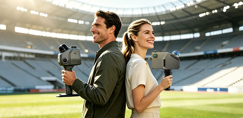
Capturing Stadiums and Arenas for Concert Productions
Concert venues are among the most demanding spaces to orchestrate. Modern touring shows are marvels of engineering, often featuring towering stage sets, massively heavy suspended lighting systems, expanding LED walls, automated platforms, and complex backstage logistics. All of these elements must fit flawlessly inside an arena or stadium.
In these immense environments, scale and absolute accuracy are the defining challenges. Teams need to deeply understand not just the stage floor, but the sweeping seating bowls, the intricate roof truss structures, high-altitude catwalks, and precise audience sightlines. For these sprawling, large-scale challenges, the Eagle scanner finds its natural home.
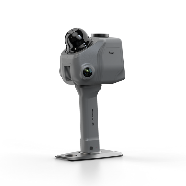
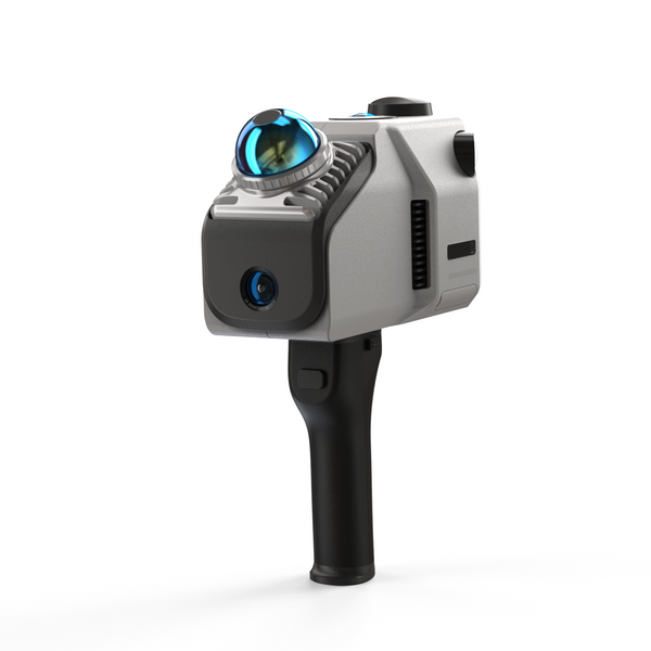
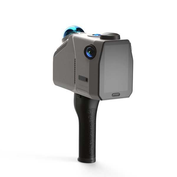
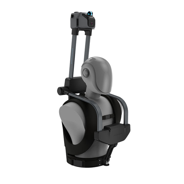
Engineered with a remarkable scanning range of up to 140 meters and an astonishing capture rate of 200,000 points per second, Eagle is thoughtfully designed for massive venues where distance and efficiency are paramount. Remarkably, it maintains its beautiful structural fidelity even while in continuous motion. This reliable stability is perfectly paired with Eagle’s thoughtful expandability—allowing production teams to seamlessly mount the device on cars, bicycles, or ergonomic backpack frames, or simply operate it handheld, dramatically elevating operational efficiency across vast venues. Even at such an immense scale and pace, it delivers an impressive precision of up to 2 centimeters at a 10-meter distance.
For outdoor stadiums and massive site layouts, Eagle takes this spatial accuracy a step further by thoughtfully supporting an RTK (Real-Time Kinematic) module. This advanced addition delivers survey-grade, centimeter-level absolute positioning. It ensures that the digital twin isn't just locally accurate, but perfectly aligned with real-world global coordinates—an invaluable asset for structural engineers mapping expansive festival grounds or checking precise clearances long before the first truck ever arrives at the loading dock.

Harmonizing Sports Venues and Opening Ceremonies
Sports venues and Olympic-level stadiums function much like breathing, interconnected small cities. They encompass layered seating zones, winding underground tunnels, VIP hospitality suites, dedicated media compounds, and sprawling emergency access paths that must all operate in absolute harmony.
When planning opening ceremonies or massive temporary overlays, organizers face the monumental task of coordinating crowd movement and sprawling performance areas across a huge footprint. The Eagle scanner’s remarkable technical reach becomes vital here. It is equipped with an expansive 360° horizontal and 59° vertical Field of View (FOV), allowing it to effortlessly capture towering grandstands and low, winding tunnels in a single, sweeping motion. To pair this geometric fidelity with visual brilliance, the system features four 48MP high-resolution fisheye cameras, delivering stunning 8K HDR imaging that documents every corner of the venue in vibrant detail as the scanner traverses the landscape.
Rather than measuring isolated corridors or single rooms one by one in a painfully slow process, production teams can continuously capture the wider venue as a beautifully connected digital ecosystem. This holistic view leads to infinitely better planning for crowd flow, accessible routes, and the seamless integration of temporary infrastructure. When the primary challenge is total venue scale, Eagle provides the sweeping perspective and rapid processing speed needed to bring everything together perfectly.
To ensure ultimate precision across such expansive grounds, the operator completes a seamless "loop closure"— locking massive amounts of spatial data together into one perfectly aligned digital twin, and bringing the capture process to a flawless close.

Transforming Brand Activations and Commercial Spaces
Not every unforgettable event requires stadium-scale coverage. Many of today’s most creative and intimate experiences happen in multi-level malls, repurposed warehouses, historic galleries, and tight commercial interiors. These spaces must be transformed quickly and flawlessly.
These projects move at an incredibly fast pace. Creative agencies may only be granted a brief, one-hour site visit before they must begin designing the space. Intricate booths, lighting displays, interactive demo zones, and guest circulation paths all need to be woven into an existing room with zero margin for error.
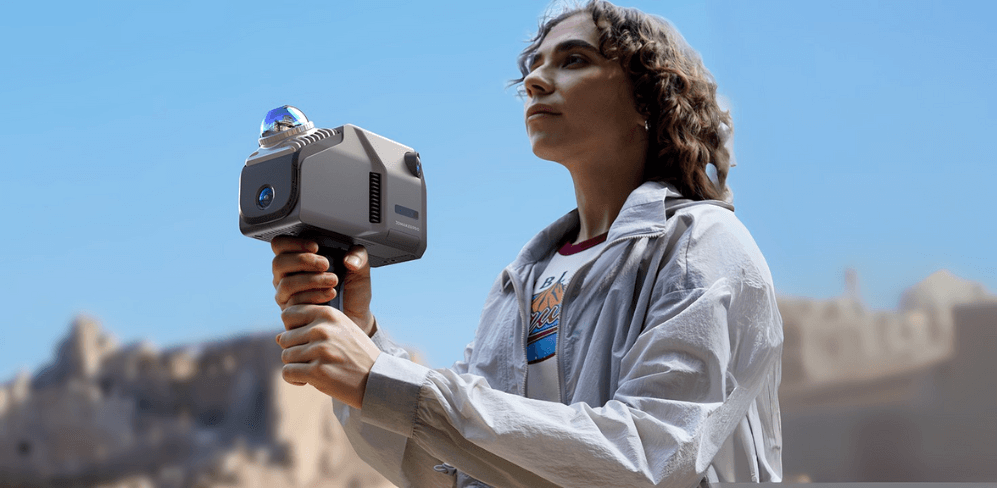
In these dynamic, fast-moving environments, the Raven scanner is an invaluable companion. Weighing just around 1.1 kg, Raven is beautifully lightweight and highly portable. Its agile design allows an operator to comfortably walk it through winding stairwells, busy interiors, and multi-floor commercial sites without fatigue. With a highly effective scanning range of around 80–100 meters, it effortlessly provides more than enough coverage for indoor event environments while maintaining the supreme agility needed to navigate tight spaces. For design teams that value speed and mobility, Raven quickly turns an empty, complex room into a design-ready digital canvas in several hours.

Designing Immersive Art Installations
Immersive art spaces and modern experiential pop-ups depend entirely on millimeter-perfect accuracy. Projection mapping must land perfectly on irregular walls and historic columns. Lighting effects need to respond naturally to the room's unique architecture, and interactive content must align flawlessly with how visitors naturally wander through the space.
Raven is particularly beautiful for this type of work because it marries practical scanning coverage with an intimately portable, handheld workflow. Despite its ultra-lightweight frame, Raven impressively delivers a survey-grade precision of up to 2 centimeters at a 10-meter distance. This allows teams to weave through black-box venues smoothly, capturing complex geometry with high fidelity.
Furthermore, its built-in 1/2-inch 12MP camera system automatically adapts to challenging indoor lighting, capturing stunningly detailed 4K color textures as the operator moves. For creative projects that demand even richer visual context, Raven offers thoughtful modularity by fully supporting the integration of external 360° cameras. This allows teams to blend precise spatial geometry with sweeping panoramic color fidelity, helping creators build temporary worlds by designing around the authentic nuances of the space rather than relying on rough estimates.

Festivals, Heritage Events, and Cultural Preservation
Cultural heritage and festival sites often present diverse documentation challenges. These locations frequently feature a mix of sprawling architectural footprints and contained interior settings, requiring a flexible approach to data acquisition. Eagle and Raven provide complementary capabilities, each suited to different operational needs.
Eagle is the preferred solution for extensive heritage sites and multifaceted ceremonial venues. Boasting a 140-meter scanning range and RTK-enabled positioning, it serves as the foundational tool for mapping massive temple grounds, historic landmarks, and wide-ranging festival sites. Its ability to process such expansive areas ensures that the spatial relationships within elaborate architectures are captured with absolute precision, establishing a solid reference for site-wide planning.
Raven is purpose-built for navigating confined interiors. Weighing only 1.1 kg, its compact, lightweight design ensures effortless operation when mapping museum galleries, historic halls, and cramped corridors. Furthermore, the hot-swappable battery grip enables uninterrupted scanning workflows, while the resulting high-fidelity data provides a precise digital reference for these enclosed spaces.
By integrating both devices, teams can effectively capture both macro-level site geography and micro-level interior details. Deploying Eagle for broad site coverage and Raven for the geometry of restricted spaces produces a complete, holistic dataset. This ensures that the full context of any cultural event or heritage site is recorded with the spatial accuracy required for professional preservation and planning.

Bringing Venues to Life with Ray Studio
Think of your LiDAR scanner as the master cinematographer on location—it possesses the keen, observant eye required to capture the raw light and geometry of the physical world. If the scanner is your lens, Ray Studio is your director’s monitor. Yet, you are the true director commanding the vision. With just a simple click, the software begins its work. It is designed to be accessible to everyone: beginners can achieve polished, satisfying results using default settings, while advanced creators have the freedom to experiment with custom parameters, fine-tuning every detail until their vision is perfectly realized.
Ray Studio’s core advantage lies in its streamlined data workflow. It excels at high-speed point cloud parsing, allowing users to process massive raw datasets into high-fidelity, colorized point clouds with ease. Furthermore, it integrates state-of-the-art Gaussian splatting, transforming complex geometric data into immersive, photorealistic 3D environments. This ensures that planners can move from raw site captures to a fully realized digital workspace without the friction of traditional, manual 3D modeling.
Ray Studio elegantly harmonizes the distinct strengths of each scanner to ensure consistent success. The Eagle functions as a professional-grade powerhouse, expertly capturing the most complex, expansive spaces and outputting color point clouds that are exceptionally vivid and exquisite. The Raven serves as an ideal entry-level solution that punches well above its weight; thanks to its modular design which supports external 360° camera attachments, its Gaussian splatting results can rival the visual fidelity of the Eagle. Whether you are deploying professional-grade hardware or an agile entry-level tool, Ray Studio ensures that both operate at their full potential, transforming raw data into a seamless and immersive event vision.

Final Thoughts
The transition from traditional site assessment to data-driven spatial planning is more than a technological upgrade—it is a fundamental shift in how events are conceived. By integrating the complementary strengths of Eagle and Raven with the intelligence of Ray Studio, you replace intuition with empirical truth. This workflow ensures that no detail is too complex to solve and no environment is too challenging to master. In an industry where time is the most expensive commodity, this level of precision doesn't just protect your schedule; it secures your reputation for excellence.

Featured collection
LiDAR scanner
Save $255.00
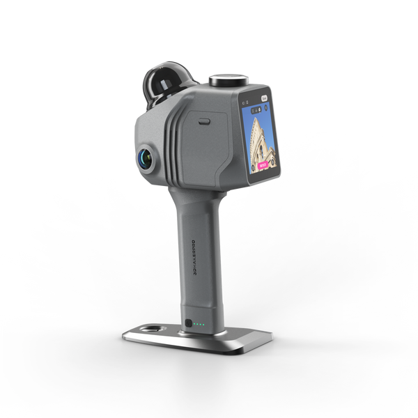
Raven LiDAR Scanner
LiDAR scanner
Save $800.00
Eagle LiDAR Scanner


