Content

A game-changer in the dynamic world of technology, spatial LiDAR scanners are altering our perspective and interaction with the physical environment. These handheld 3D scanners, once the stuff of science fiction, are now transforming industries, from architecture to entertainment, by providing unprecedented accuracy and detail in capturing spatial data. In this article, we delve into the fascinating world of spatial LiDAR scanners, exploring their workings, and shining a spotlight on 3DMakerpro's all-new Eagle LiDAR Scanner.
What is LiDAR?
LiDAR, which stands for Light Detection and Ranging, is a remote sensing technology that measures distances by illuminating targets with laser light and analyzing the reflected light. The data collected is used to create detailed, three-dimensional representations of environments, objects, and even living organisms. Unlike traditional imaging methods, LiDAR can capture fine details and produce high-resolution images in a variety of conditions, including complete darkness.
How Spatial LiDAR Scanners Work
At the heart of spatial LiDAR technology is the principle of time-of-flight. When a laser pulse is emitted from the scanner, it travels to the target and reflects to the sensor. By calculating the time taken for the pulse to return, the scanner determines the distance to the target with remarkable precision. This process is repeated millions of times per second, capturing a dense cloud of points that represent the scanned environment.
Spatial LiDAR scanners utilize advanced algorithms and data processing techniques to convert these point clouds into meaningful data. The result is a detailed 3D model that can be used for various applications, from mapping terrain to creating virtual environments. These portable scanners are equipped with high-resolution cameras that enhance the accuracy and richness of the captured data, allowing for the integration of color and texture information.

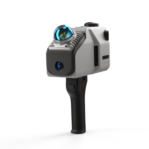
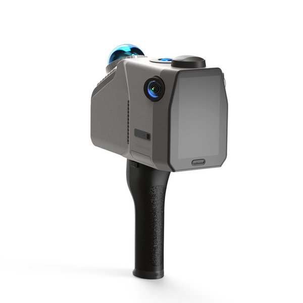
Introducing 3DMakerpro's Eagle LiDAR Scanner
Enter the 3DMakerpro Eagle LiDAR Scanner: a game-changer in the world of spatial 3D scanning. Designed to turn views into data and reality into virtuality, the Eagle LiDAR Scanner is packed with cutting-edge features that make it an indispensable tool for professionals and hobbyists alike.
Key Features
a) Up to 140 meters scan range: Capture expansive areas with precision.
8K Ultra Imaging: High-definition imaging for incredibly detailed scans.
b) LiDAR 360°Ultra-Wide FOV, 80m Range: Comprehensive field of view for complete environmental capture.
c) Cameras: 48MP, FOV 180°, f/2.0: Eagle: 48MP x 1 | Eagle Max: 48MP x 4. Superior resolution and wide-angle coverage.
d) 12,000 mAh battery, 60 mins runtime: Extended battery life for prolonged scanning sessions.
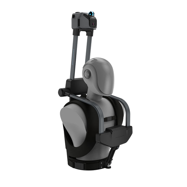
e) Handheld & Data Collection: Portable and user-friendly design.
f) Lightweight and Portable: Easy to carry and use in the field.
g) Indoor / Outdoor Scanning: Versatility for various environments.
h) Detail, Color, and Texture Capture: Transforms visual elements into precise data.
i) Quick and Efficient Scans: Minimize downtime with rapid data collection.
j) Mountable: Expand your scanning capabilities on bicycles or drones with aerial shots.
k) 3D Gaussian Splatting: Advanced data processing for superior 3D modeling.
l) Accuracy:
2cm @ 10m | 0.8 inch @ 33 feet
3cm @ 20m | 1.1 inch @ 66 feet
5cm @ 40m | 1.9 inch @ 131 feet

Real-Life Applications
The versatility of the Eagle LiDAR Scanner opens up a plethora of real-life applications. For instance, interior designers can use the scanner to create detailed mock-ups of home interiors, facilitating better design decisions and client presentations. Surveyors and architects can quickly capture accurate measurements of buildings and landscapes, streamlining the planning and construction process.
Outdoor enthusiasts and environmental scientists can mount the scanner on drones to conduct aerial surveys of forests, coastlines, and other natural features, aiding in environmental monitoring and conservation efforts. The scanner's ability to capture fine details and textures makes it an invaluable tool for creating realistic virtual environments for gaming and entertainment.
Conclusion
Spatial handheld 3D scanners, with their ability to capture the world in exquisite detail, are transforming how we interact with and understand our surroundings. 3DMakerpro's Eagle LiDAR Scanner, with its state-of-the-art features and unparalleled performance, is at the forefront of this technological revolution. Whether you're an industry professional or a tech enthusiast, the Eagle LiDAR Scanner offers endless possibilities for turning views into data and reality into virtuality.
Embrace the future of spatial scanning with 3DMakerpro and discover a world of limitless potential.


Featured collection
LiDAR scanner
Eagle LiDAR Scanner
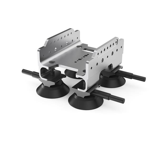
Automotive Rooftop Mount


