Content

Outdoor surveying is often shaped by constraints, including terrain, distance, access, and time. Whether you're mapping land, documenting infrastructure, or building large-scale 3D environments, the real challenge isn’t just capturing data, but doing it efficiently across complex and changing conditions.
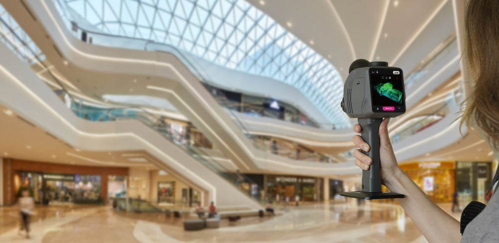
A LiDAR scanner for topographical survey changes alters that equation. Tools like the 3DMakerpro Raven, with up to 100 meters of scanning range, centimeter-level accuracy, and real-time SLAM, enable continuous data capture while moving—turning large outdoor environments into complete, structured 3D scenes in a single pass.
For Walking Surveyors: Ergonomic and Hands-Free in Complex Terrain
Topographical survey work often begins where roads end—forests, uneven terrain, and early-stage construction sites. In these environments, efficiency depends on how naturally you can move through the space without interruption, especially when working with a modern LiDAR solution.
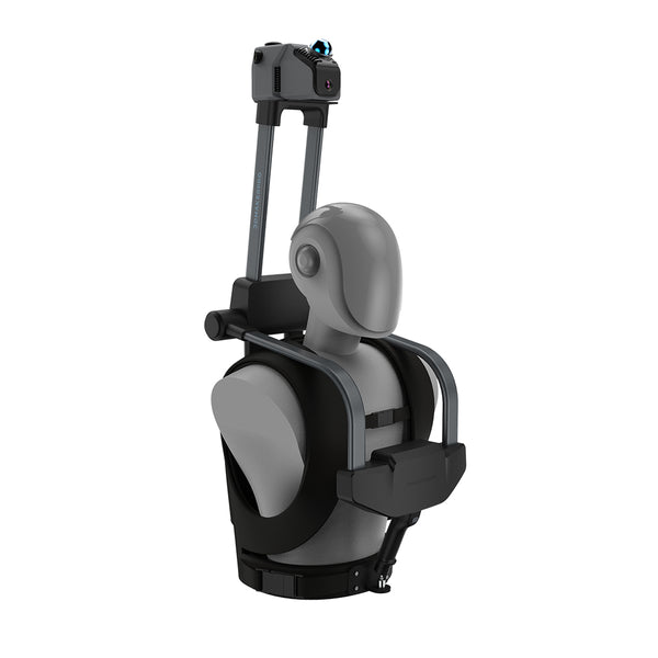
With an ergonomic backpack system, a LiDAR scanner for topographical surveying, like 3DMakerpro Raven, integrates seamlessly into your workflow. The scanner is mounted securely on a frame above your head, while the backpack distributes weight comfortably across your body. This ergonomic design keeps the device stable during movement and eliminates the need to hold it by hand.
As a result, your hands are completely free, and your movement remains fluid. Combined with its lightweight build (around 1.1 kg), wide 360° × 40° field of view, and up to 50-meter scanning range, this type of terrain scanning solution enables continuous data capture across large outdoor areas—reducing fatigue while significantly improving efficiency.

For Cyclists and Mobile Mapping: Capture While in Motion
As workflows become more dynamic, especially in urban and semi-urban environments, stopping to scan is no longer practical. Whether mapping streets or documenting large outdoor spaces, mobility becomes a key advantage.
Mounted on a bicycle, a topographical LiDAR scanner allows you to move freely through streets and pathways while continuously capturing spatial data. As you ride and navigate through the city, the scanner quietly records its structure and subtle changes—turning everyday movement into a powerful mapping process.
This approach is especially valuable for capturing long routes and interconnected urban environments. Instead of fragmented scans, you get a continuous, evolving 3D record of the city—efficient, fluid, and closer to how spaces are actually experienced with a mobile mapping LiDAR system.
For Vehicle-Based Surveying: Scale Without Slowing Down
When projects expand to roads, infrastructure corridors, or large-scale sites, distance becomes the primary challenge. Traditional workflows—based on repeated stops—quickly become inefficient in large-area mapping scenarios.
By mounting the system on a vehicle, a LiDAR system for land survey can capture large areas in a single drive. With a high acquisition rate of up to 150,000 points per second, 3DMakerpro Raven records dense spatial data even in motion, maintaining accuracy across extended distances.
This transforms large-area mapping into a continuous process. Instead of breaking projects into smaller segments, entire routes can be documented efficiently, making it an ideal approach for professionals handling extensive terrain surveys.

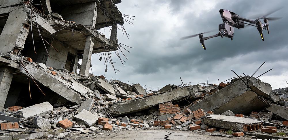
For Aerial Surveying: Reach What You Can’t Access
Some environments remain difficult, risky, or even impossible to reach on foot or by vehicle—such as elevated structures, steep terrain, or restricted zones.
In these cases, mounting a LiDAR scanner for topographical surveying on a drone provides a practical solution. With the addition of an RTK module, the system can utilize GPS-based positioning to achieve accurate, georeferenced data in outdoor environments—making it suitable for precise mapping and surveying applications.
This not only improves safety by reducing the need for manual access but also expands the scope of what can be captured efficiently. Hard-to-reach areas become accessible, without compromising data quality.
Built for Real Outdoor Conditions
Outdoor environments are unpredictable, with changing light, complex surfaces, and extended operation times placing demands on any equipment used in the field.
As a topographical LiDAR scanner, 3DMakerpro Raven captures geometry directly using laser measurements, making it far less sensitive to lighting conditions than image-based methods. Its modular battery handle, the 3DMakerpro Raven Grip, can be quickly swapped, allowing you to continue working seamlessly even when power runs out—without interrupting your workflow.
In addition, the 3DMakerpro Raven LiDAR Scanner supports an external 360° camera that can be easily mounted onto the bracket system. This enhances color capture and significantly improves Gaussian Splatting results—delivering richer visuals and more immersive, true-to-life representations of outdoor environments.

Work Without Interruption
In outdoor surveying, efficiency is not just about speed—it’s about continuity. The less you need to stop, adjust, or repeat, the more productive your workflow becomes.
A Lidar scanner for topographical survey enables this shift by adapting to different working methods—from walking and cycling to driving and aerial capture. Instead of forcing you to adjust your process, it supports a smoother, more connected way of working.
Because in the end, working faster outdoors isn’t about rushing — It’s about never breaking your flow.

Featured collection
LiDAR scanner
Save $255.00
Raven LiDAR Scanner
Backpack Kit


