Content
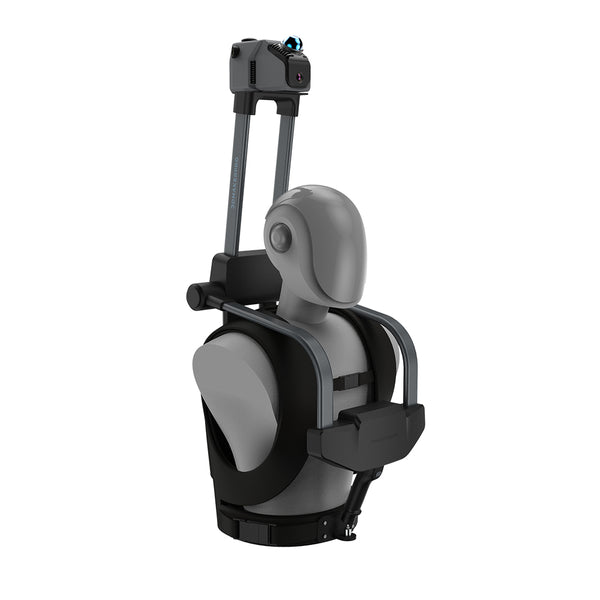
Laser 3D scanning is a transformative technology that captures the physical characteristics of objects or environments and converts them into detailed digital 3D models. By utilizing laser beams to measure distances with remarkable precision, this process creates a comprehensive representation of the scanned subject. One notable advancement in this field is the Eagle LiDAR Scanner, which integrates cutting-edge features to enhance the laser scanning experience. In this blog, we will delve deeper into the mechanics of laser 3D scanning, its diverse applications, its advantages, and how the Eagle LiDAR Scanner stands out.

How Does Laser 3D Scanning Work?
"Within the field of 3D object scanning, laser scanning (also known as lidar) combines controlled steering of laser beams with a laser rangefinder. By taking a distance measurement in every direction the scanner rapidly captures the surface shape of objects, buildings, and landscapes. Construction of a full 3D model involves combining multiple surface models obtained from different viewing angles, or the admixing of other known constraints. Small objects can be placed on a revolving pedestal, in a technique akin to photogrammetry." -- From Wikipedia
Applications of Laser 3D Scanning
1. Architecture and Engineering Industry
a. Street Planning
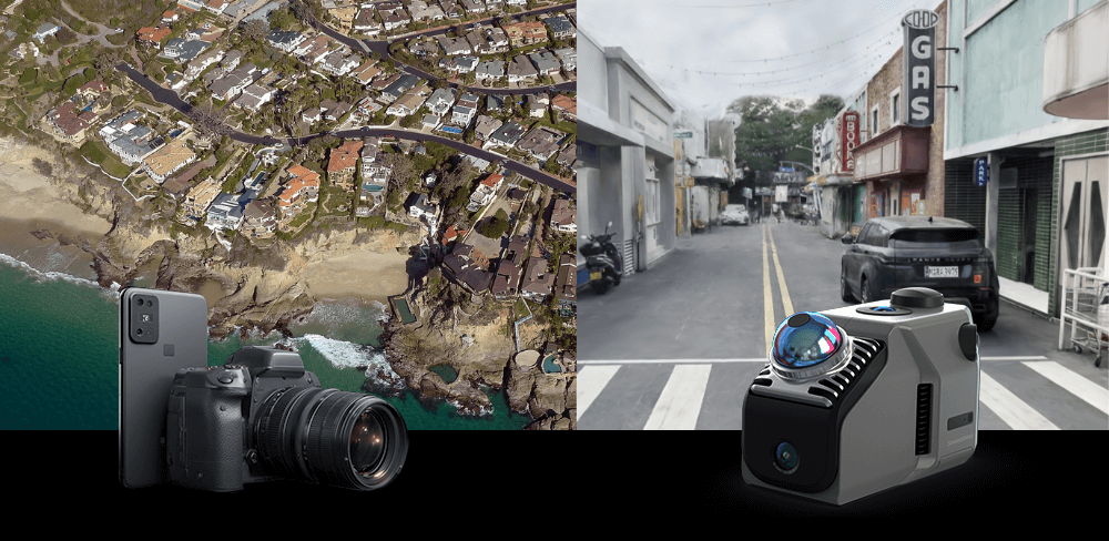
The Eagle Lidar scanner features a single scanning radius of 70 meters (with 80% reflectivity) and can acquire motion data at speeds of up to 20 km/h. It efficiently scans large areas (150m x 150m) in under five minutes, significantly enhancing engineers' ability to accurately collect street data for urban road planning and maintenance. With associated modeling software, users can easily model, analyze, and optimize street layouts in 3D.
b. Building Construction Measurement
The Eagle Lidar scanner offers accuracy levels of 2cm@10m, 3cm@20m, and 5cm@40m, ensuring the reliability of collected data suitable for high-precision design and mapping tasks. It performs rapid, high-precision measurements at construction sites, aiding architects and engineers in recording and comparing construction progress in 3D.

2. Real Estate and Interior Design
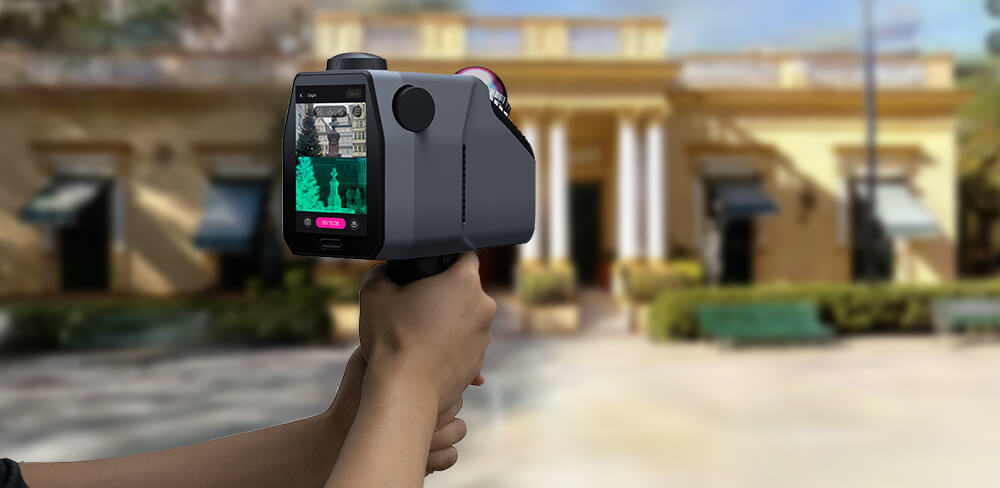
a. Real Estate Showcase
Equipped with a 4 x 48 MP HD Camera System, the Eagle can produce 8K HDR Ultra-HD panoramic images. This leading-edge imaging capability allows for detailed laser scans of building interiors and exteriors, creating highly accurate 3D models for online and virtual showings, facilitating effective communication between agents and buyers.
b. Interior Design
When paired with powerful modeling software, the Eagle enables designers to make modifications to digital home design models, enhancing both efficiency and accuracy in the design process. Real-time design visualization helps minimize resource waste and reduces the costs associated with trial and error.

3. Film and TV Production and Game Development
a. Film and TV production
The Eagle can generate environment models using SLAM technology, allowing for real-time positioning and scanning of complex indoor spaces with multiple routes and levels. It is ideal for various scene types. Additionally, when combined with GPS data, it supports absolute and relative coordinate positioning, enabling integration with maps to display scanning results. This makes it suitable for film, TV, or commercial production, generating digital scenes for special effects and animation.
b. Game Development
The Eagle provides options for first-person, top-down, and 45-degree viewpoints to accommodate diverse environments in data collection and 3D modeling. This versatility enables realistic scene reproduction for video games and virtual reality (VR) applications, enhancing the overall gaming experience.

4. Protection of Cultural Relics and Sites
a. Scanning and Protection of Cultural Relics
The Eagle Lidar is a high-precision spatial scanner with accuracy levels of 2 cm at 10 m, 3 cm at 20 m, and 5 cm at 40 m. It can scan cultural relics without causing damage, accurately recording their shape and texture for digital archiving and protection, facilitating future restoration and exhibition.
b. Reproduction and Protection of Cultural Sites
The Eagle supports large-area scanning with a radius of 40-70 meters and a range of 80-140 meters. It offers various output formats, including color point cloud PLY and panoramic roaming PNG+OBJ, allowing for non-destructive and accurate scanning of cultural heritage sites. This technology aids in digital archiving, online display, and future restoration efforts.

5. 3D Cloud Exhibition
a. Multi-Scene Application
The Eagle Lidar scanner is versatile, and suitable for displaying multiple scenes such as homes, museums, exhibitions, shopping malls, and tourist attractions. It enhances indoor and outdoor presentations, offering a novel experience. Furthermore, its built-in 12,000 mAh battery lasts for one hour and supports simultaneous charging and operation, impressing both individual users and enterprises.
b. Online Display and Sharing
Scanned data is compatible with multiple devices, including mobile phones, tablets, laptops, and computers. Users can share their scans via links or QR codes on social media, while businesses can embed them into their websites to create online exhibition halls, effectively showcasing their offerings to a global audience.

6. Public Safety
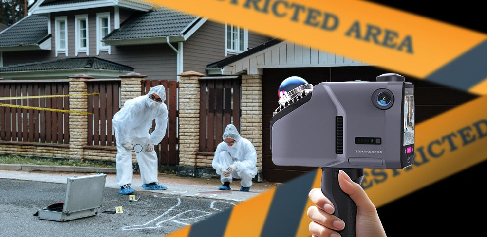
a. Crime Scene Investigation
The Eagle Lidar scanner offers motion acquisition speeds of up to 20 km/h, enabling rapid collection of 3D data in complex environments. It supports three viewpoints: first-person, overhead, and 45-degree overhead, ensuring that environmental details and key evidence are preserved. The scanner generates high-precision 3D models to accurately reconstruct accident scenes, crime scenes, or disaster areas. Additionally, the accompanying software allows for marking, distance measurement, and area delineation, providing intuitive data support for case investigations. The digital model of evidence also enhances cross-departmental and cross-regional sharing, facilitating collaborative investigations.
b. Fire Emergency
The Eagle Lidar scanner employs SLAM technology and GPS data to accurately map complex indoor spaces, generating precise 3D models of commercial and residential buildings that detail firefighting equipment and escape routes. In the event of a fire, these models enable firefighters to quickly assess the scene, enhancing safety and rescue times. With an accuracy of 2cm at 10m, 3cm at 20m, and 5cm at 40m, the scanner's data serves as a vital resource for accident investigations, legal proceedings, insurance claims, and reconstruction efforts. Additionally, it supports various output formats, allowing fire departments to effectively educate the public on fire safety and improve community awareness and emergency preparedness.

Conclusion
Laser 3D scanning is revolutionizing how we capture and represent the physical world. Its precision, speed, and versatility make it an invaluable tool in many industries, from architecture to public safety. The Eagle LiDAR Scanner, with its advanced imaging capabilities and high accuracy, exemplifies the potential of this technology. By utilizing laser scans, we can obtain detailed and accurate representations of various objects and environments. As advancements continue, we can expect even more innovative applications and enhancements in laser 3D scanning, driving its adoption across various sectors. Whether for preservation, design, or manufacturing, laser scanning can enrich our understanding and interaction with our environment, paving the way for a more digital and interconnected future.

Featured collection
LiDAR scanner
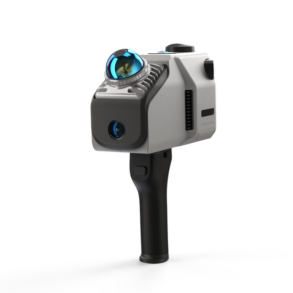
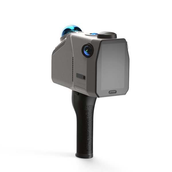
Eagle LiDAR Scanner
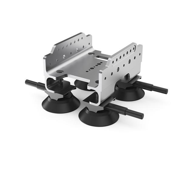
Automotive Rooftop Mount


