Content
LiDAR (Light Detection and Ranging) is reshaping the way we study and protect wildlife habitats. By emitting laser pulses and measuring their reflections, LiDAR creates detailed 3D maps of landscapes, enabling conservationists to analyze terrain, vegetation, and biodiversity with unprecedented accuracy. Unlike traditional imaging methods, LiDAR mapping services can penetrate dense foliage, revealing hidden ecological features that are crucial for habitat preservation.
Understanding LiDAR Technology in Conservation
LiDAR 3D mapping plays a pivotal role in wildlife conservation. It helps researchers track environmental changes, assess animal habitats, and plan reforestation efforts. Whether deployed via drones, aircraft, or handheld scanners, LiDAR technology provides an in-depth understanding of ecosystems, supporting sustainable conservation strategies.
The Role of LiDAR Mapping in Wildlife Protection
1. Monitoring Habitat Changes
Wildlife habitats are constantly evolving due to climate change, deforestation, and human activities. LiDAR services offer precise measurements of topography and vegetation density, helping ecologists detect early signs of habitat degradation and implement timely conservation plans.

2. Animal Behavior Analysis
LiDAR mapping captures intricate details of animal movement by analyzing terrain structures. Conservationists can use this data to study migration patterns, identify critical breeding grounds, and ensure safe passage for endangered species.
3. Preventing Human-Wildlife Conflict
In regions where human settlements encroach on wildlife territory, LiDAR technology aids in designing effective barriers and safe corridors. By mapping terrain elevations and vegetation density, conservationists can create solutions that minimize conflicts between humans and wildlife.

4. Enhancing Reforestation and Carbon Stock Estimation
LiDAR mapping services assist in reforestation efforts by identifying suitable planting areas and measuring forest canopy density. Additionally, LiDAR data is used to estimate carbon stocks, helping policymakers develop strategies for carbon sequestration and climate action.
How LiDAR Mapping Services Empower Conservationists
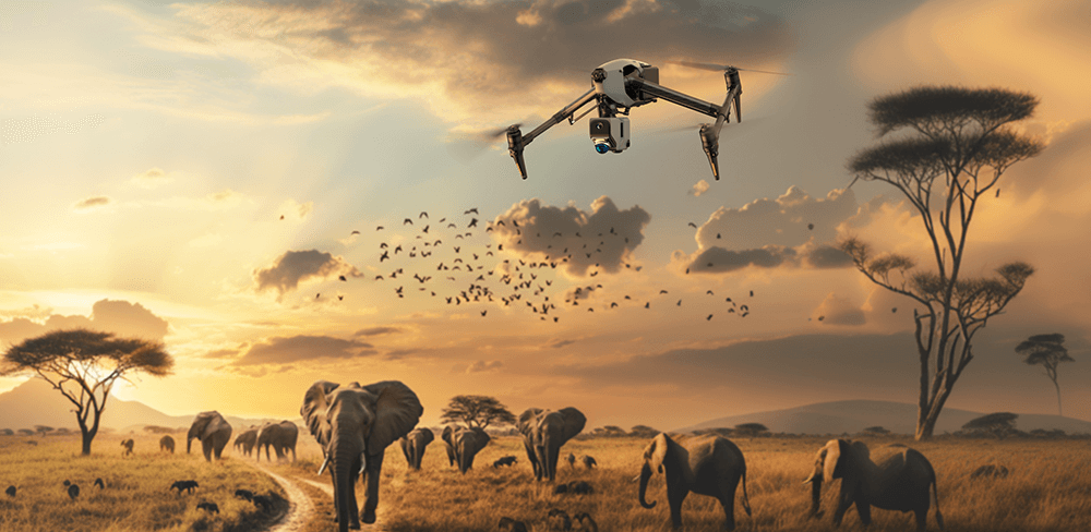
1. Drone-Based LiDAR Surveys
Drones equipped with LiDAR sensors provide an aerial perspective of wildlife habitats. By flying over dense forests and rugged terrains, researchers can gather high-resolution spatial data without disturbing natural ecosystems.

2. Ground-Based LiDAR for Detailed Analysis
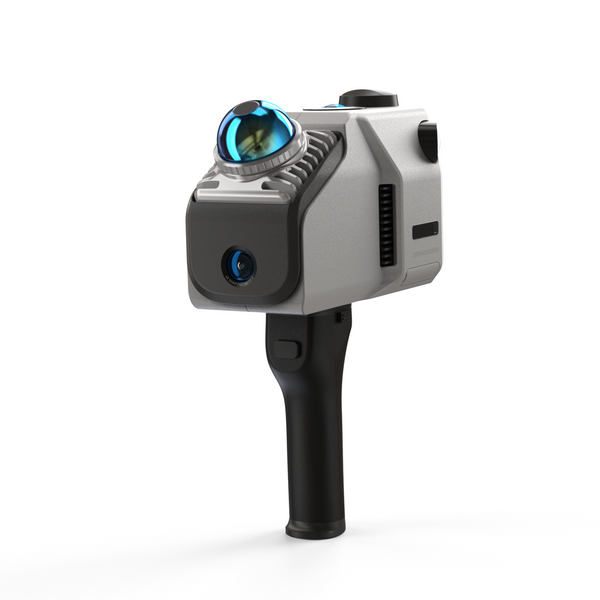
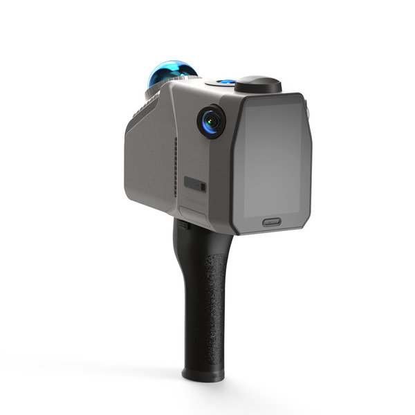
Handheld LiDAR scanners like the Eagle allow conservationists to scan forest floors, caves, and other hard-to-reach areas, generating precise 3D models of animal habitats. This is particularly useful for studying species that rely on specific environmental conditions for survival.
3. Automated Data Processing for Efficient Conservation Planning
With RayStudio, a free software developed by 3DMakerpro, researchers can seamlessly process LiDAR data. RayStudio offers automatic point cloud stitching, filtering, and denoising, enabling conservation teams to extract actionable insights without requiring extensive technical expertise.

Key Features of RayStudio:
Denoising & Filtering – Removes noise and irrelevant data for clearer visualizations.
Multiple Export Formats – Supports LAS, PCD, and PLY file formats for compatibility with various analysis tools.
User-Friendly Interface – Enables researchers to process data easily, even without advanced technical expertise.
Customization Options – Adjust point size, color type, and transparency for enhanced visualization.

Eagle LiDAR Scanner: A Game-Changer in Conservation Mapping
For conservationists and environmental researchers, having a reliable LiDAR scanner is essential. The Eagle LiDAR Scanner from 3DMakerpro stands out as an innovative tool for wildlife habitat mapping, offering unmatched precision and efficiency.
Key Features of Eagle LiDAR Scanner for Habitat Mapping:
Up to 140m Scan Range: Captures vast landscapes with high accuracy.
8K Ultra Imaging: Produces highly detailed 3D models for ecological analysis.
360° Ultra-Wide FOV: Ensures complete environmental coverage.
48MP High-Resolution Cameras: Enhances point cloud data with color and texture details.
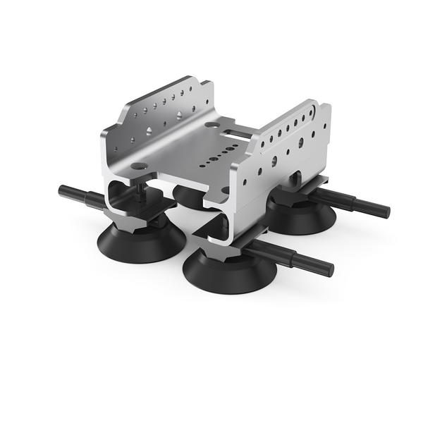
Portable & Mountable Design: Ideal for field researchers, adaptable for drone and vehicle mounting.
Advanced Data Processing with RayStudio: Automatically processes LiDAR data, including point cloud stitching, denoising, and filtering, ensuring high-quality outputs.

The Future of LiDAR in Wildlife Conservation
As LiDAR mapping services continue to evolve, their applications in conservation will expand. Future advancements may include AI-driven habitat analysis, real-time monitoring systems, and global LiDAR datasets for cross-border ecological studies. By integrating LiDAR technology with RayStudio software, we can better protect wildlife and preserve biodiversity for generations to come. For researchers, ecologists, and conservationists looking for a high-performance LiDAR scanner, the Eagle LiDAR Scanner from 3DMakerpro offers the precision and efficiency needed to make a real impact.Explore the Eagle LiDAR Scanner today and revolutionize your wildlife habitat mapping efforts!


Featured collection
LiDAR scanner
Eagle LiDAR Scanner

RTK Antenna & Signal Module (Pre-Installation Only)


