Content
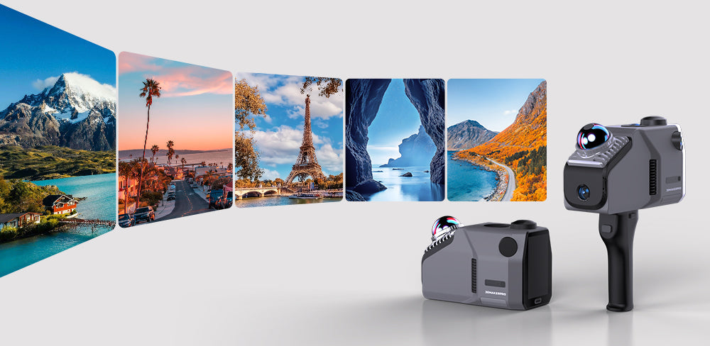
In a world where travel is often limited by time, health, budget, or physical barriers, 3D scanning technology is transforming exploration. LiDAR scanners are opening new doors to virtual tourism, allowing anyone to explore immersive digital landscapes. From ancient sites to lush forests, this technology brings distant destinations to our fingertips, offering endless opportunities to discover the world from home.
Key Benefits of Radar Scanners
1. Vivid 3D Spatial Models
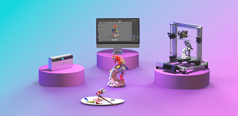
When paired with specialized software, LiDAR spatial scanners generate highly detailed 3D models that offer a dynamic, immersive experience far beyond traditional 2D photography. These scanners capture not just the visual features but also the intricate geometries of landscapes and structures. Each scan creates a digital twin, reflecting the spatial relationships and features of the environment. Unlike static images, which capture a single moment, LiDAR models allow users to explore multiple angles and perspectives, revealing the full complexity of a location.
Imagine wandering through a digitally rendered forest, where you can marvel at towering trees while examining the subtleties of the forest floor. The ability to zoom in on intricate details—like the texture of bark or the layering of foliage—adds depth, enriching the narrative of the scene. As users navigate these virtual landscapes, they don’t just observe; they learn about the significance of these places, uncovering hidden stories and natural wonders that might otherwise be overlooked. This creates a new avenue for storytelling, where art, geography, and history intersect in powerful ways.

2. Empowering Travel Bloggers
Travel bloggers can harness LiDAR scanners to document their journeys and capture stunning landscapes, transforming their digital narratives into immersive 3D experiences. Imagine a blogger trekking through Patagonia’s rugged terrains, mapping breathtaking vistas that their audience can explore in virtual 3D. For those unable to travel, these virtual adventures offer a sense of connection, allowing them to experience the excitement and awe of exploration from home.
Integrating 3D scans into a blog not only enhances visual appeal but also provides deeper context behind each destination. Bloggers can offer insights into local culture, ecological significance, and historical relevance, while allowing followers to engage interactively. Users can explore virtual landscapes in ways traditional photos can’t capture. This fusion of storytelling and virtual exploration transforms passive reading into an active, shared adventure, fostering a deeper connection between bloggers and their audience.

3. Non-Destructive Documentation in Museums and Archaeology
Museums and archaeologists can use LiDAR scanners to document fragile sites and artifacts non-destructively, a critical step in preserving cultural heritage. Traditional methods often risk damaging delicate items or disrupting archaeological sites, but LiDAR allows for precise, respectful documentation. Detailed 3D models ensure that priceless pieces of history remain intact while providing educational resources for a global audience.
The potential of this technology is transformative. Virtual exhibits created from LiDAR data offer immersive experiences, enabling people worldwide to appreciate artifacts and archaeological finds. This not only educates the public about their historical significance but also fosters a deeper appreciation for heritage preservation. By bringing the past to life through interactive exploration, museums can inspire interest in cultural history and advocate for the conservation of these invaluable legacies.

4. Nostalgic Preservation for 3D Scanning Enthusiasts
For 3D scanning enthusiasts, capturing landmarks during their travels provides a way to immortalize cherished memories. Using LiDAR, individuals can create digital keepsakes of their favorite destinations—whether it’s a serene beach at sunset, a bustling city square, or an iconic monument. These digital representations serve as personal mementos while contributing to a global archive, allowing others to share in these experiences.
Platforms that support user-uploaded scans create a vibrant community of explorers, bringing people together to explore stunning scenery and virtually journey around the world. This sharing fosters collaboration and cultural exchange, uniting enthusiasts with common interests. By contributing to this collective digital memory, individuals help build a rich, shared archive of the world’s wonders, allowing others to experience them from home, regardless of physical limitations.

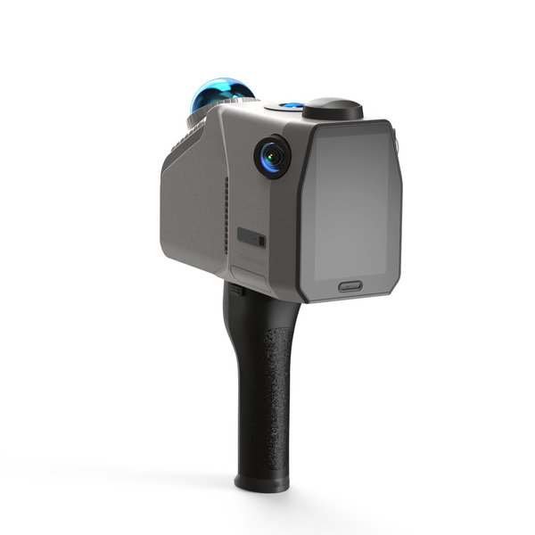
Eagle LiDAR Laser Scanner: Elevate Your Scanning Experience
a) Exceptional Imaging Quality
The Eagle LiDAR Scanner is equipped with a high-definition 48MP camera system, capable of producing ultra-clear 8K HDR panoramic images. With precision accuracy—2 cm at 10 meters, 3 cm at 20 meters, and 5 cm at 40 meters—the Eagle ensures the reliability of collected data. Users can easily scan and document their travels with vivid, color-accurate 3D data, ensuring that every stone, tree, and artifact is realistically represented.

b) Highly Adaptable
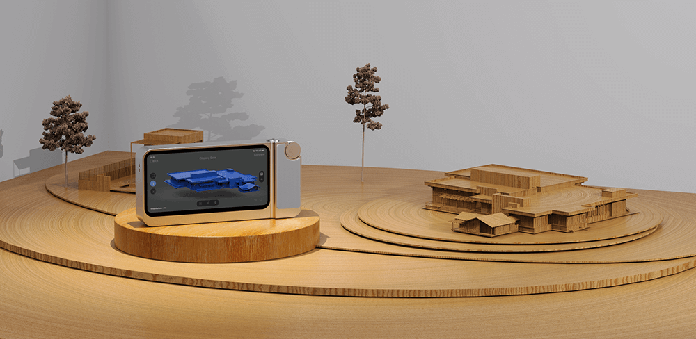
The Eagle is perfect for both complex indoor and expansive outdoor environments. It uses SLAM (Simultaneous Localization and Mapping) technology to build models and capture intricate spaces with multiple paths and floors. By incorporating GPS data for precise coordinate positioning, the scanner produces accurate and valuable results for mapping and measurement needs. Whether in indoor or outdoor settings, the Eagle handles it all with ease. Professional-grade surveying technology helps users gain a deeper understanding of local tourist attractions.
c) User-Friendly
With multiple perspectives to choose from—first-person, top-down, and 45-degree top-down views—the Eagle adapts to various scanning environments and requirements. It supports a range of output formats, including colored point clouds (PLY), panoramic tours (PNG + OBJ), Gaussian splash (PLY), and more, simplifying post-processing and analysis for diverse applications. This flexibility streamlines the workflow for both professionals and enthusiasts.
d) Flexible Operation
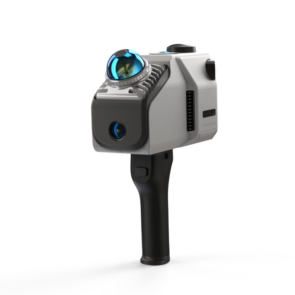
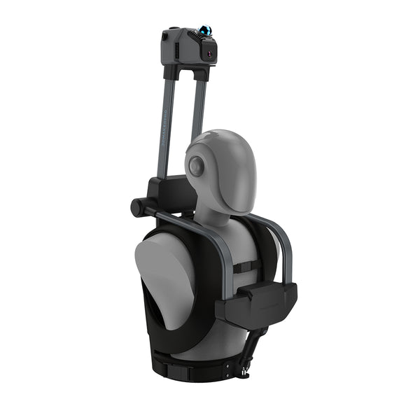
Compact and lightweight, the Eagle measures 115x181x106 mm and weighs just 1.5 kg. It comes with a built-in 12,000mAh battery and supports charging while scanning. It can also be mounted on bicycles, cars, or drones for scanning on the move—making it the perfect companion for road trips.
Have a Nice Trip!
LiDAR scanners are revolutionizing virtual tourism, offering immersive 3D models and enabling bloggers, museums, and enthusiasts to explore and share the world in new ways. These innovations make global wonders more accessible, allowing anyone to embark on virtual adventures from home. The future of travel may be virtual, but its impact is real, providing endless opportunities for discovery, learning, and appreciation. Happy exploring!

Featured collection
LiDAR scanner
Save $800.00
Eagle LiDAR Scanner
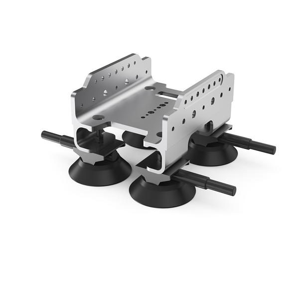
Automotive Rooftop Mount


