Contenu
Ces dernières années, la technologie de numérisation 3D a révolutionné de nombreux domaines, notamment la géologie et la sédimentologie. En fournissant des représentations précises et détaillées des formations rocheuses et des structures sédimentaires, la numérisation 3D transforme la façon dont les chercheurs étudient les matériaux terrestres. Un outil remarquable dans ce domaine est le Scanner LiDAR Eagle, qui améliore les capacités des géologues et des sédimentologues. Ce blog explore comment la numérisation 3D, notamment avec le scanner LiDAR Eagle, révolutionne l'étude des roches et des sédiments grâce à des analyses efficaces. scan 3D de sédiments rocheux techniques. 
Qu'est-ce que la numérisation 3D ?
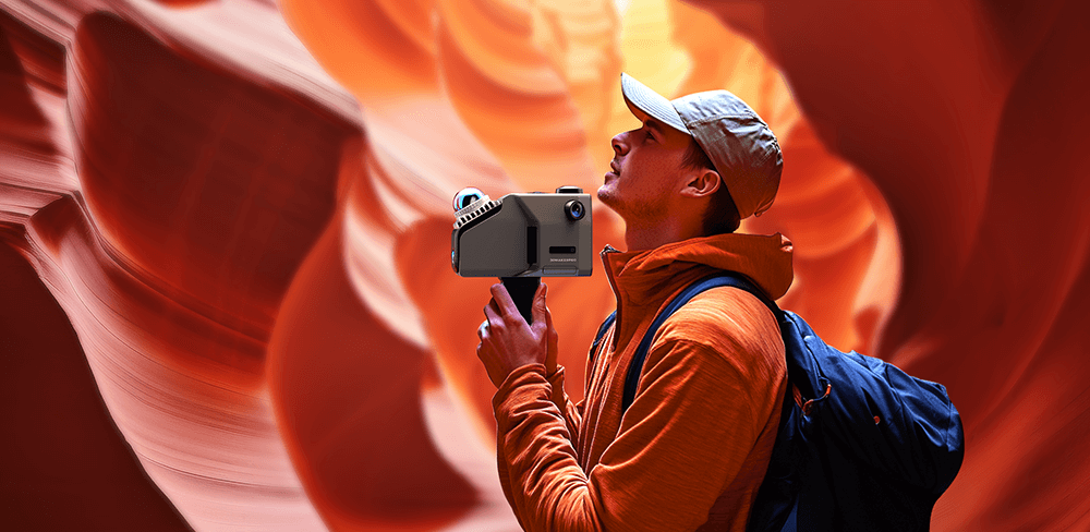
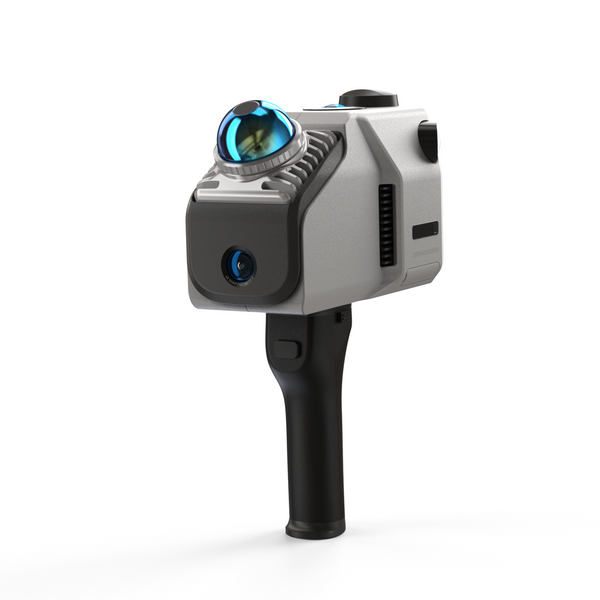
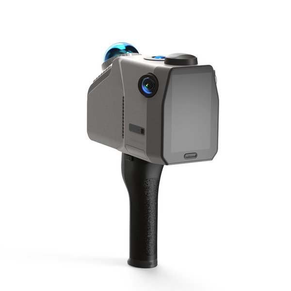
La numérisation 3D consiste à capturer les caractéristiques physiques d'un objet ou d'un environnement et à les convertir en un modèle numérique 3D. Différentes techniques, telles que la numérisation laser, la photogrammétrie et la numérisation par lumière structurée, sont utilisées pour capturer des détails complexes. Le scanner LiDAR Eagle, équipé d'un système avancé de 4 caméras haute définition de 48 Mpx, produit des images panoramiques 8K HDR ultra-nettes. Cette capacité d'imagerie de pointe garantit aux utilisateurs des données 3D riches en détails et aux couleurs précises, ce qui le rend idéal pour les applications exigeant une haute résolution et une qualité d'image exceptionnelle, notamment dans les domaines suivants : scan 3D de sédiments rocheux projets.
Collecte de données améliorée
L'un des principaux avantages de la numérisation 3D est l'amélioration des processus de collecte de données. Les méthodes traditionnelles d'étude des roches et des sédiments impliquent souvent des mesures et des photographies manuelles, ce qui peut être chronophage et manquer des détails cruciaux. Grâce au scanner LiDAR Eagle, les chercheurs peuvent rapidement collecter des ensembles de données complets avec une grande précision : 2 cm à 10 m, 3 cm à 20 m et 5 cm à 40 m. Ce niveau de précision garantit la fiabilité des données collectées, ce qui le rend idéal pour les applications de conception et de topographie exigeant une grande précision. scan 3D de sédiments rocheux tâches.
Étude de cas : L'utilisation du balayage laser dans la cartographie géologique
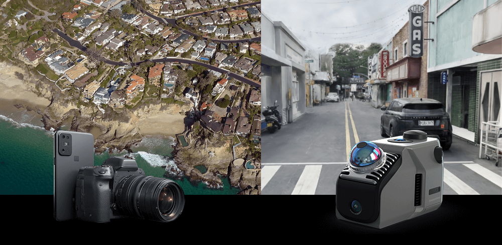
La numérisation laser s'est révélée particulièrement efficace en cartographie géologique. La capacité de numérisation de scènes étendues du scanner LiDAR Eagle, couvrant un rayon unique allant jusqu'à 70 m et numérisant une vaste zone (150 m x 150 m) en moins de 5 minutes, améliore considérablement l'efficacité du travail. Les chercheurs qui étudient un affleurement rocheux peuvent créer un modèle 3D détaillé révélant des caractéristiques structurelles, telles que des failles et des plis, qui peuvent ne pas être visibles sur les images 2D traditionnelles. Cette collecte rapide de données permet aux géologues d'effectuer des interprétations plus précises de l'histoire et des processus géologiques, améliorant ainsi l'efficacité de leurs travaux. scan 3D de sédiments rocheux méthodologies.

Visualisation et analyse améliorées
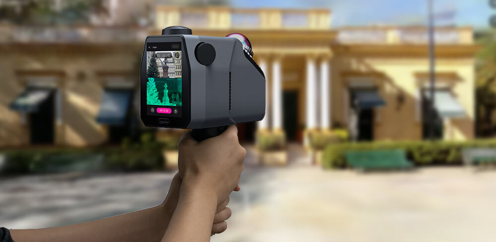
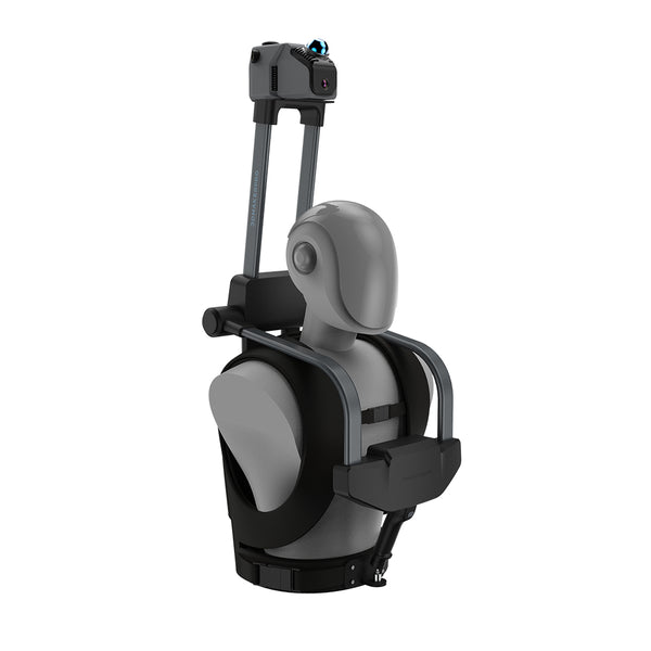
Les modèles 3D constituent un puissant outil visuel pour les géologues et les sédimentologues. Au lieu de se fier uniquement aux images 2D, les chercheurs peuvent manipuler et explorer des représentations 3D de leurs zones d'étude. Le scanner LiDAR Eagle offre une capture multi-points de vue avec trois options de visualisation : vue à la première personne, vue aérienne et à 45 degrés, permettant ainsi des opérations de capture dans différents environnements. Cette fonctionnalité facilite une meilleure compréhension des structures géologiques complexes et des processus sédimentaires, notamment lors des opérations de capture. scan 3D de sédiments rocheux opérations.
Modèles interactifs pour l'éducation et la recherche
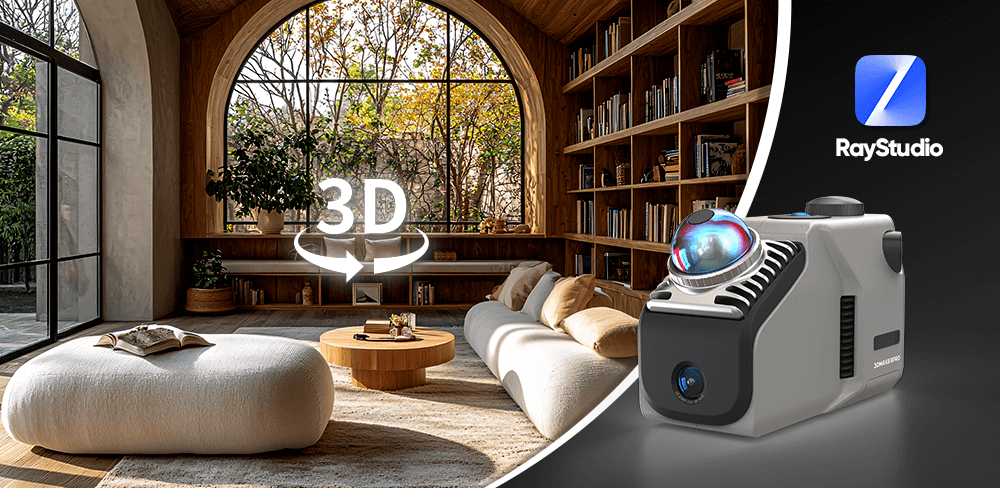
Les avantages pédagogiques de la numérisation 3D sont également considérables. Les modèles 3D interactifs peuvent être utilisés en classe et en recherche, permettant aux étudiants et aux chercheurs d'explorer les caractéristiques géologiques de manière dynamique. Cette expérience immersive favorise un apprentissage approfondi et une implication accrue dans la matière, rendant scan 3D de sédiments rocheux projets plus efficaces et engageants. Vous pouvez utiliser Logiciel Ray Studio pour générer des éclaboussures gaussiennes, parcourez votre modèle spatial 3D ou téléchargez-le sur le Site Web de JIMUMETA pour un visionnement public en ligne.

Préservation du patrimoine géologique
La numérisation 3D est non seulement utile à la recherche actuelle, mais joue également un rôle crucial dans la préservation du patrimoine géologique. En créant des archives numériques des formations rocheuses et des structures sédimentaires importantes, les chercheurs peuvent préserver ces informations pour les générations futures. Ceci est particulièrement important dans les zones exposées au risque d'érosion ou d'activité humaine susceptible de compromettre ces caractéristiques naturelles.
Applications en sciences de l'environnement
Les applications de la numérisation 3D dépassent la géologie traditionnelle. En sciences de l'environnement, elle permet d'étudier le transport des sédiments, l'érosion et les processus de dépôt. La capacité du scanner LiDAR Eagle à construire des modèles environnementaux grâce au SLAM et au positionnement en temps réel permet une modélisation précise d'espaces intérieurs et extérieurs complexes. En analysant des modèles 3D de lits de rivières ou de zones côtières, les scientifiques peuvent mieux comprendre l'évolution de ces environnements au fil du temps et prédire les changements futurs, améliorant ainsi leurs connaissances. scan 3D de sédiments rocheux capacités en études environnementales.
La numérisation 3D révolutionne l'étude des roches et des sédiments en permettant une collecte de données plus précise, une visualisation améliorée et la préservation des caractéristiques géologiques. Le scanner LiDAR Eagle, avec son imagerie haute définition, sa précision et son efficacité, améliore considérablement ces capacités. Avec les progrès technologiques, son intégration à la recherche géologique permettra probablement d'approfondir notre compréhension des processus et de l'histoire de la Terre. L'avenir de la géologie ne réside pas seulement dans les roches elles-mêmes, mais aussi dans les paysages numériques créés par les technologies de numérisation 3D. En adoptant ces innovations, notamment dans scan 3D de sédiments rocheux Grâce aux applications, les chercheurs peuvent découvrir de nouvelles perspectives et ouvrir la voie à de futures découvertes dans le domaine.
Collection vedette
LiDAR scanner
Scanner LiDAR Eagle
Module d'antenne et de signal RTK


