Contenu
Alors que les zones urbaines s'étendent pour répondre aux besoins d'une population croissante, la technologie LiDAR s'impose comme une véritable révolution dans le développement des villes intelligentes. En fournissant une cartographie 3D précise et une analyse des données en temps réel, les capteurs LiDAR optimisent la gestion du trafic et l'urbanisme, améliorant ainsi la sécurité et la durabilité. Dans cet article, nous analysons l'influence profonde de la technologie LiDAR sur les villes modernes, en présentant ses applications et ses avantages. Nous mettrons également en lumière les solutions avancées, telles que 3DMakerpro's Eagle LiDAR, ouvrent la voie à des transformations urbaines innovantes.
Le rôle du LiDAR dans les villes intelligentes
1. Améliorer la gestion du trafic et la sécurité routière
L'une des applications les plus critiques de Scanner LiDAR Eagle Dans les villes intelligentes, la gestion du trafic est essentielle. Les systèmes de surveillance traditionnels s'appuient largement sur des caméras et des radars, dont les capacités peuvent être limitées par les conditions d'éclairage et les préoccupations en matière de confidentialité. Les capteurs LiDAR, quant à eux, fournissent des données 3D en temps réel sur les mouvements des véhicules, l'activité des piétons et la congestion routière, sans compromettre la confidentialité des données.
En déployant des scanners LiDAR aux intersections et sur les autoroutes, les villes peuvent :
- Détectez les collisions évitées de justesse et identifiez les zones sujettes aux accidents.
- Optimisez la synchronisation des feux de circulation en fonction du flux de véhicules en temps réel.
- Améliorez la sécurité des piétons en surveillant les passages pour piétons et les tendances à traverser hors des passages piétons.
- Activez la communication des véhicules autonomes grâce à l'intégration V2X (Vehicle-to-Everything) .
Par exemple, les corridors d'intersection intelligents utilisent de plus en plus de logiciels de perception LiDAR pour analyser le volume de trafic, les risques de collision et les tendances de mobilité. Cette technologie fournit aux villes des informations exploitables qui contribuent à réduire les embouteillages et à améliorer la sécurité routière.

2. Urbanisme et surveillance des infrastructures
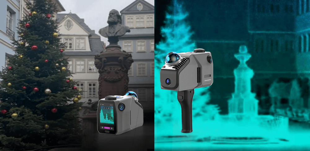
Les urbanistes ont besoin de données spatiales de haute précision pour concevoir des villes plus efficaces et plus résilientes. Scanners Eagle LiDAR permettre des mesures sans contact, permettant une cartographie détaillée des paysages urbains, y compris les bâtiments, les routes et les espaces publics.
Grâce à la technologie LiDAR, les urbanistes peuvent :
- Réaliser des relevés topographiques précis pour des projets de construction.
- Surveiller l'état de l'infrastructure en détectant l'usure structurelle.
- Prévenez les problèmes d'inondation et de drainage grâce à l'analyse du terrain.
- Optimiser l'utilisation du sol en analysant la densité de population et la disposition des bâtiments.
Les capteurs LiDAR industriels sont intégrés dans l'infrastructure des villes intelligentes pour assurer une surveillance continue en temps réel, garantissant que les structures urbaines restent sûres et bien entretenues.

3. Sécurité publique intelligente
La sécurité et la surveillance sont essentielles dans les environnements urbains, mais les problèmes de confidentialité limitent souvent l'utilisation de caméras haute résolution. Capteurs Eagle LiDAR proposer une solution en fournissant une imagerie 3D anonyme, capable de détecter des modèles de mouvement sans capturer des traits du visage identifiables.
Les villes qui utilisent des scanners LiDAR pour la sécurité peuvent :
- Surveillez la densité de la foule dans les espaces publics pour éviter la surpopulation.
- Détectez les activités suspectes à proximité des infrastructures critiques.
- Améliorer les interventions d'urgence en cartographiant les zones sujettes aux catastrophes.
- Améliorez l'efficacité des forces de l'ordre grâce à une connaissance de la situation en temps réel.
Par exemple, la fusion des données LiDAR avec les flux vidéo traditionnels améliore les capacités de surveillance, permettant une meilleure surveillance de la sécurité tout en préservant les normes de confidentialité.

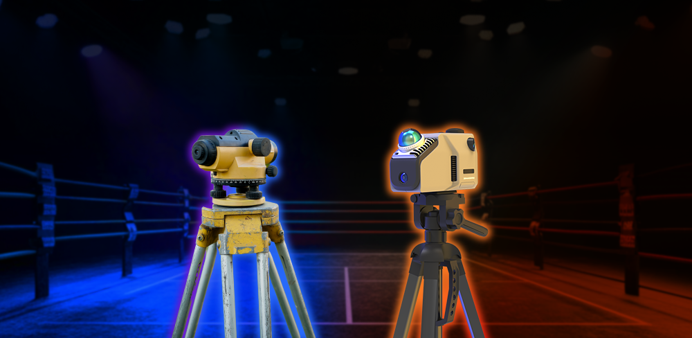
LiDAR vs. autres capteurs
La technologie LiDAR surpasse les caméras et les radars des villes intelligentes par sa précision, sa cartographie 3D en temps réel et sa fiabilité par tous les temps. Contrairement aux caméras, elle garantit la confidentialité en capturant des données spatiales plutôt que des images, et elle est performante en basse lumière. Tandis que le radar détecte les objets, le LiDAR offre une résolution supérieure pour une cartographie urbaine détaillée, ce qui en fait le choix idéal pour les villes du futur.
L'avenir des villes intelligentes avec le LiDAR
À mesure que la technologie LiDAR évolue, son rôle dans les villes intelligentes va s'accroître. Les scanners LiDAR de nouvelle génération, tels que 3DMakerpro's Eagle LiDAR, établissent de nouvelles normes en matière de cartographie 3D de haute précision.
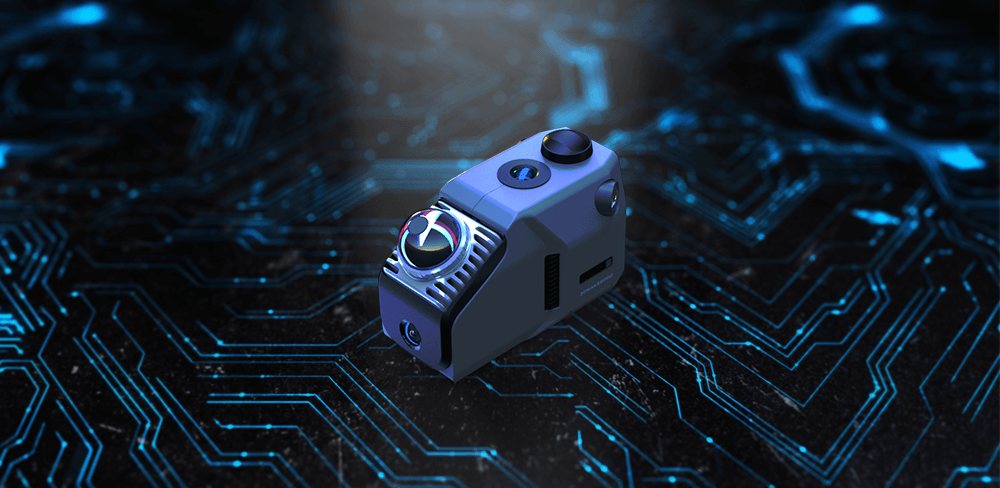
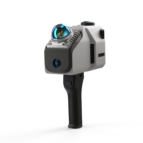
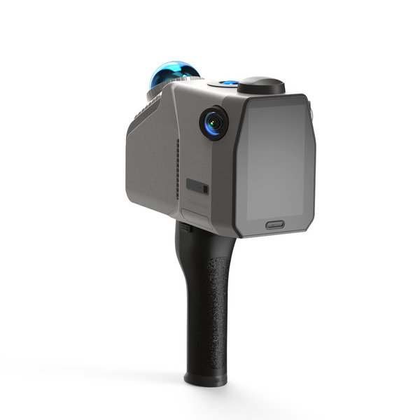
Présentation du 3DMakerpro Scanner LiDAR Eagle
Le scanner Eagle LiDAR est conçu pour les professionnels recherchant une collecte de données urbaines précise et efficace. Doté de la technologie avancée de projection gaussienne 3D, il transforme les environnements réels en modèles virtuels détaillés.
Principales caractéristiques du scanner Eagle LiDAR :
- Numérisation ultra-large à 360° : Capture des données environnementales complètes dans un rayon de 70 m.
- Imagerie 8K HDR : Les caméras haute résolution de 48 MP fournissent une cartographie urbaine détaillée.
- Traitement des nuages de points en temps réel : Prend en charge la révision du nuage de points sur site avec un écran intégré de 3, 5 pouces.
- Numérisation de haute précision : Atteint une précision de 2 cm à 10 m, garantissant une modélisation précise de la ville.
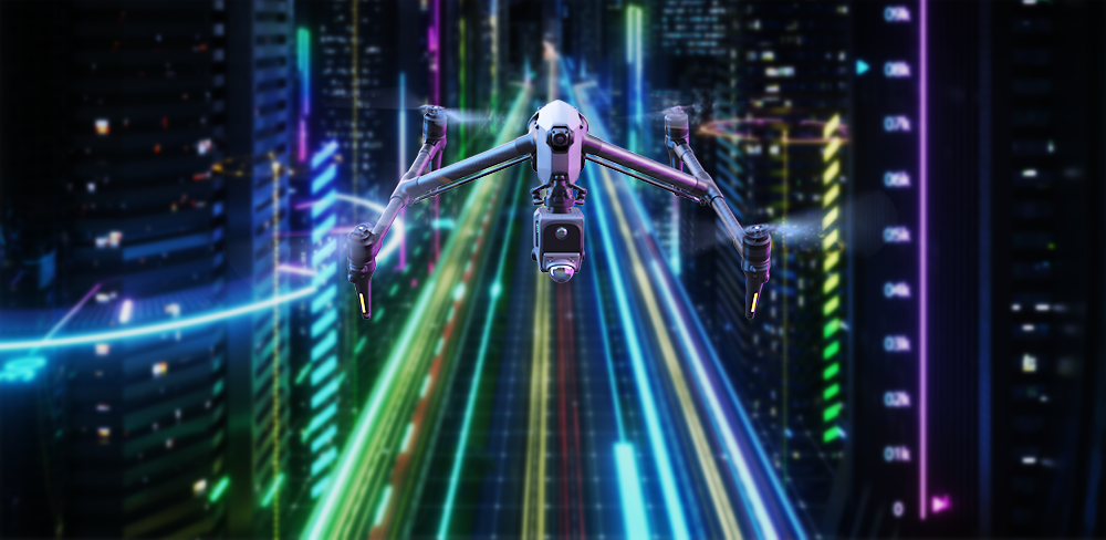
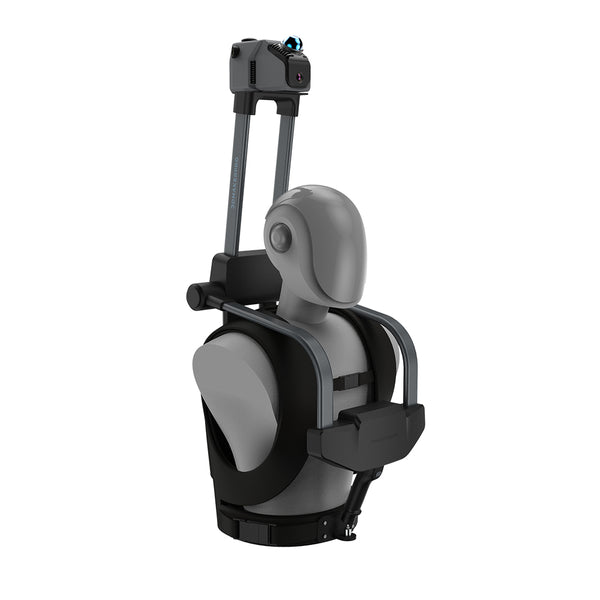
- Déploiement adaptable : Montable sur des véhicules, des drones et des sacs à dos pour une numérisation urbaine polyvalente.
- Acquisition rapide de données : Traite 200 000 points par seconde, optimisant l'analyse urbaine.
-
Résilience aux intempéries : Fonctionne bien dans des conditions de faible luminosité et de mauvais temps, garantissant une collecte de données fiable.
Que ce soit pour l'urbanisme, la construction ou la surveillance de sécurité, le Scanner LiDAR Eagle fournit une solution transparente et de haute précision pour les villes intelligentes modernes.

Conclusion
La technologie LiDAR transforme le développement des villes intelligentes en fournissant des données de haute précision et en temps réel pour la gestion du trafic, la surveillance des infrastructures et la sécurité publique. Ses avantages par rapport aux systèmes traditionnels incluent une précision accrue, le respect de la vie privée et une adaptabilité à divers environnements. Grâce à des solutions comme 3DMakerpro Eagle LiDARLes urbanistes peuvent créer des espaces urbains plus sûrs et plus efficaces. En adoptant cette technologie innovante, les villes peuvent ouvrir la voie au développement durable et à un mode de vie intelligent, garantissant ainsi un avenir meilleur pour tous. Découvrez les incroyables avantages du LiDAR et exploitez dès aujourd'hui le potentiel de révolutionner vos projets d'urbanisme !
Collection vedette
LiDAR scanner
Economisez $800.00
Scanner LiDAR Eagle
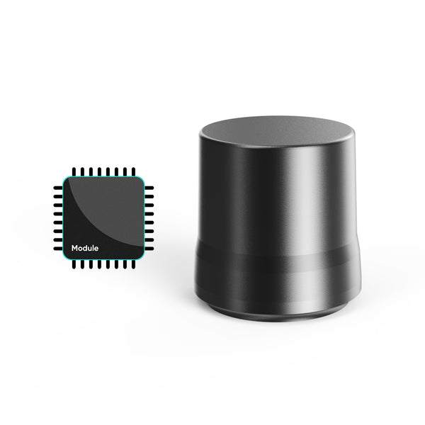
Module d'antenne et de signal RTK


